

Description
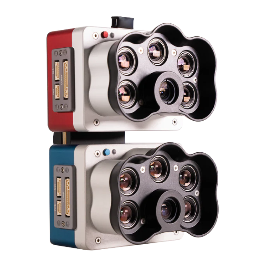
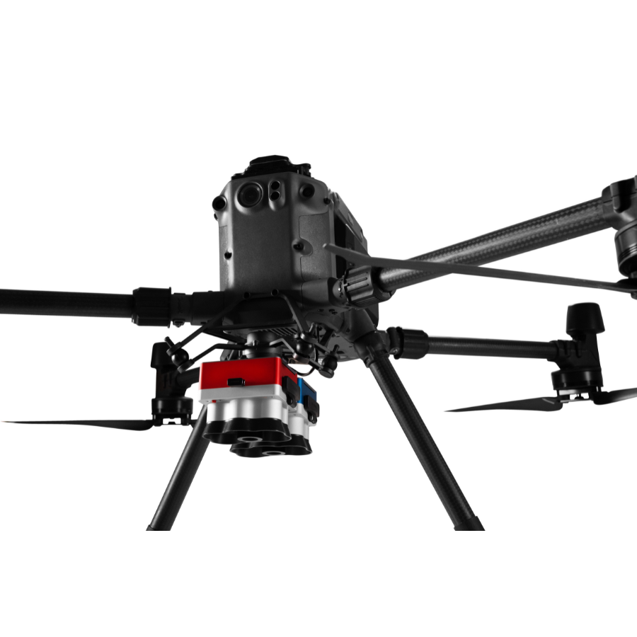
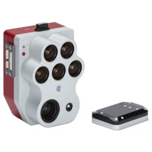
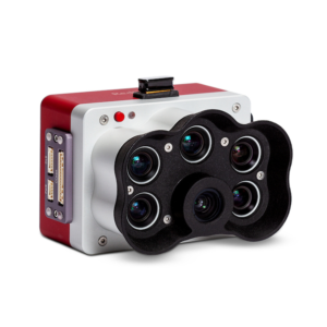
The Micasense RedEdge-P Dual is an advanced multispectral imaging device designed for drones in agriculture and environmental monitoring. Featuring dual cameras, it captures images across five spectral bands, offering improved accuracy for evaluating crop health and optimizing resources. Built with durability and equipped with global shutter technology, it delivers reliable, high-quality images under various lighting conditions. Compatible with a range of **drones**, it provides flexible deployment options. Paired with powerful analytics software, the system enables efficient image processing and analysis, offering real-time insights. This makes it a top choice for professionals aiming to enhance agricultural productivity and environmental management through cutting-edge drone imaging technology.
| Feature | Description |
|---|---|
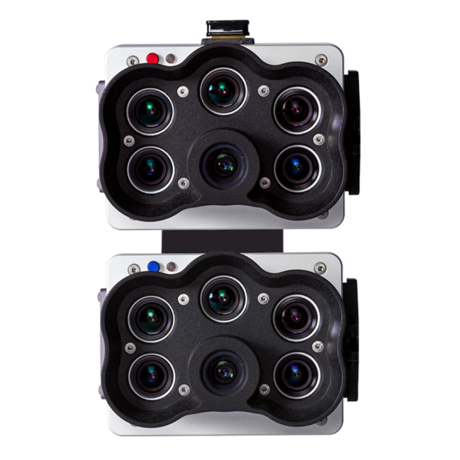
| Dual Camera System | Equipped with two advanced cameras, the system delivers superior multispectral imaging, significantly enhancing the clarity and accuracy of data across five crucial spectral bands. This dual configuration improves the ability to provide detailed insights into plant health and stress indicators, supporting precision agriculture and environmental monitoring. |
| Five Narrow Spectral Bands | Designed with carefully selected wavelengths for comprehensive vegetation analysis, these spectral bands are key in detecting various indicators of plant health. This allows for accurate identification of stress, vigor, and overall crop condition, providing valuable insights for optimizing agricultural yields and supporting environmental conservation efforts. |
| Global Shutter Technology | Incorporates global shutter sensors that capture clear images without distortion or motion blur, ensuring sharp and consistent imagery in all operational environments. This technology is essential for aerial data collection, delivering reliable, high-quality images even in challenging flight or environmental conditions. |
| High-Resolution Imaging | Offers ultra-high-resolution images, enabling detailed analysis at the individual plant level. This level of precision is vital for early detection of issues, precise crop monitoring, and informed decision-making, leading to more efficient agricultural practices and improved environmental management strategies. |
| Versatile Lighting Performance | Designed to operate effectively in a wide range of lighting conditions, from bright sunlight to low-light settings such as dawn or dusk. This adaptability ensures high-quality, usable data in diverse environmental scenarios, providing consistent results for reliable analysis and decision-making. |
| Rugged Construction | Built with a durable design to withstand harsh field conditions, the system is resistant to dust, water, and impact. Its robust construction ensures reliable performance in demanding agricultural and environmental applications, making it ideal for continuous use in tough environments. |
| Drone and UAV Compatibility | Compatible with a variety of drones and UAVs, offering flexibility for various operational scales and requirements. Whether for small-scale precision farming or large-scale environmental monitoring, this system adapts easily for comprehensive data capture. |
| Advanced Analytics Software | Paired with cutting-edge software that simplifies the processing and analysis of complex multispectral imagery. The software provides powerful, intuitive tools for efficient data analysis, allowing users to quickly derive meaningful insights and make informed decisions for agricultural and environmental management. |
| Precision Agriculture Focus | Specifically designed to meet the demands of precision agriculture, this system helps optimize resource use, detect diseases early, and boost crop yields through data-driven decision-making. Its accuracy and precision in data collection make it an essential tool for modern, sustainable farming practices that emphasize efficiency and productivity. |
| Environmental Monitoring Support | Provides critical capabilities for environmental conservation efforts, including detailed vegetation mapping, habitat analysis, and long-term ecosystem monitoring. This system is an invaluable tool for conservationists and environmental scientists working to preserve biodiversity, manage natural resources sustainably, and promote responsible land use practices. |

Reviews
There are no reviews yet.