

Description
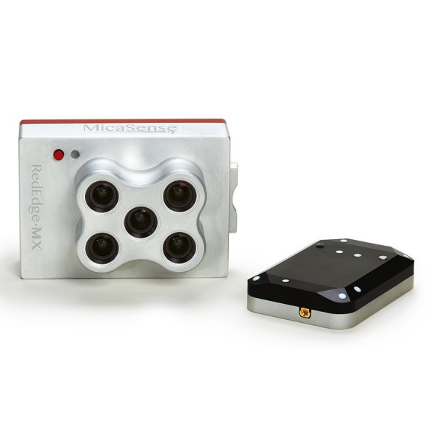
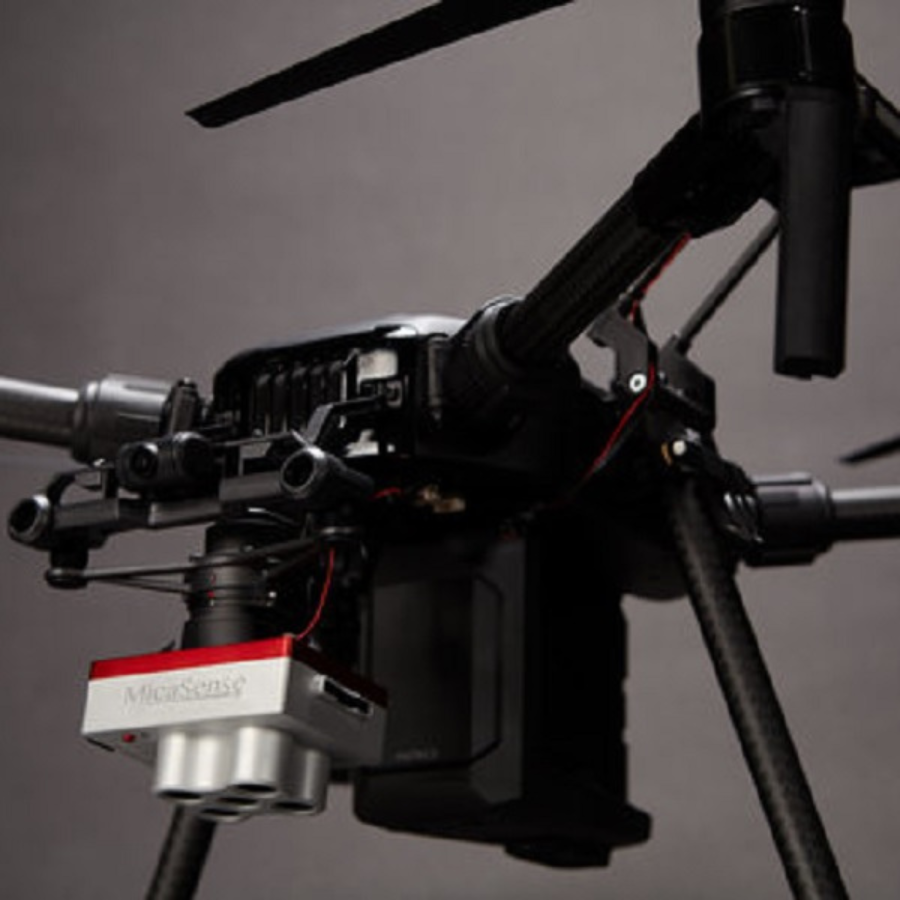
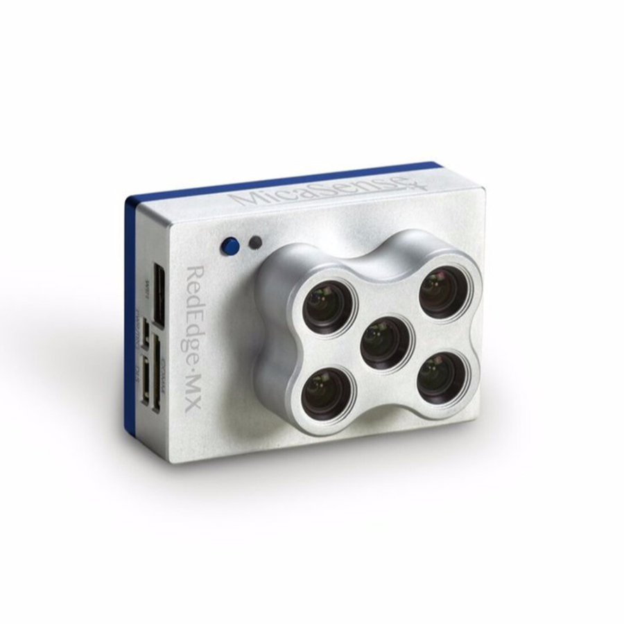
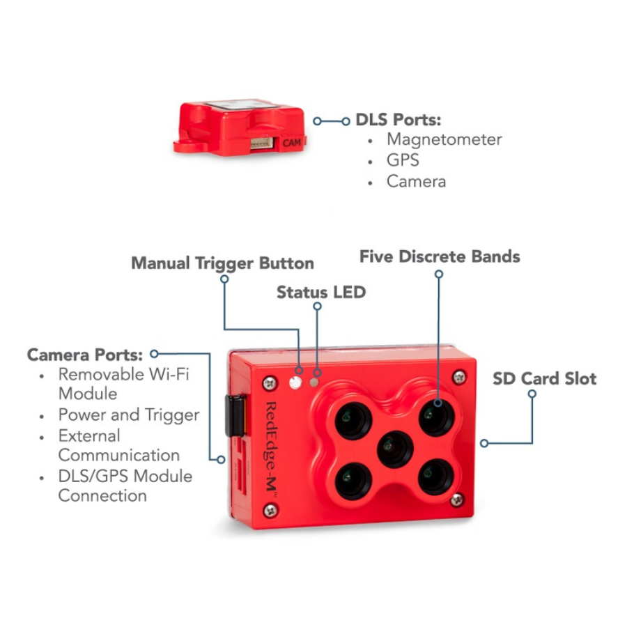
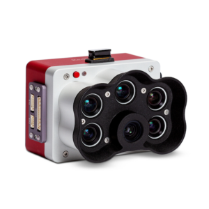
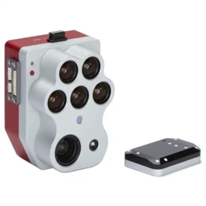
The MicaSense RedEdge-MX sensor is a compact, rugged, and highly accurate multispectral camera tailored for professional agricultural monitoring and analysis. Designed to capture data across five specific spectral bands – blue, green, red, red edge, and near-infrared (NIR) – it provides crucial insights into plant health, vigor, and nutrient levels. This advanced sensor is compatible with a wide variety of UAVs, allowing for easy integration into existing workflows. Capable of generating precise vegetation index maps and in-depth analytics, the RedEdge-MX is an essential tool for precision agriculture, helping farmers and agronomists make data-driven decisions to boost crop yields, optimize resource use, and monitor plant health over time.
| Feature | Description |
|---|---|
| Five Spectral Bands | Captures data in five essential wavelengths – blue, green, red, red edge, and near-infrared (NIR) – crucial for accurate vegetation analysis and crop monitoring. |
| High-Resolution Imaging | Delivers detailed, high-resolution images that offer valuable insights into crop health, enabling early detection of potential issues. |
| Fast Capture Rate | Provides rapid image capture, allowing efficient data collection over large areas, even at low altitudes or high speeds. |
| All-Weather Capability | Designed to perform reliably in diverse lighting conditions, from bright sunlight to overcast days, ensuring consistent data collection. |
| Seamless Drone Integration | Compatible with a variety of drones and UAVs, allowing easy incorporation into existing setups without major modifications. |
| Advanced Data Analytics | Supports sophisticated software tools to process data into actionable insights, such as vegetation indices and crop health maps. |
| Precision Agriculture Focus | Ideal for precision farming, aiding in targeted crop management, optimizing irrigation, and early disease detection. |
| Rugged Design | Built to endure harsh outdoor and aerial conditions, ensuring long-lasting durability and reliability. |
| GPS Tagging | Integrates GPS data with imagery for accurate geolocation, facilitating precise mapping and time-based analysis. |
| Flexible Configuration | Offers customizable settings to suit different aircraft and missions, including both single and synchronized capture modes. |
| Easy Connectivity | Features Wi-Fi for seamless data transfer and remote operation, improving workflow efficiency. |
| Energy-Efficient | Engineered for low power consumption, extending operational time while minimizing the impact on drone battery life. |
| User-Friendly Software | Comes with intuitive software for easy setup, calibration, and data processing, making it accessible to users of all experience levels. |
| Comprehensive Support | Backed by extensive resources, tutorials, and dedicated customer support to help users maximize the sensor’s potential. |
| Data-Driven Insights | Empowers farmers to make informed, data-driven decisions for more efficient crop management, reducing waste and enhancing productivity. |

Reviews
There are no reviews yet.