Description
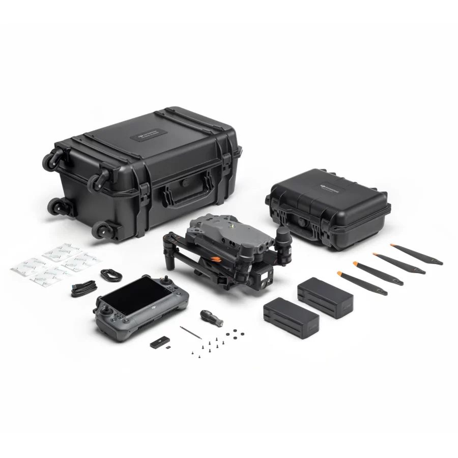
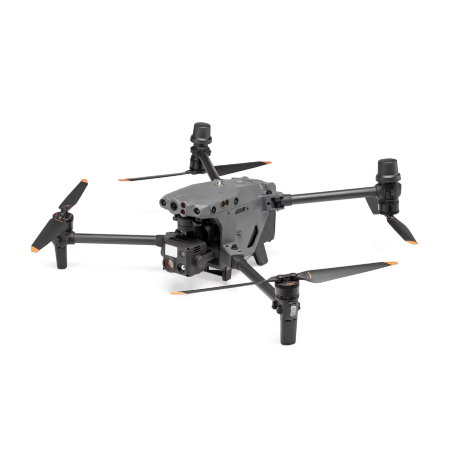
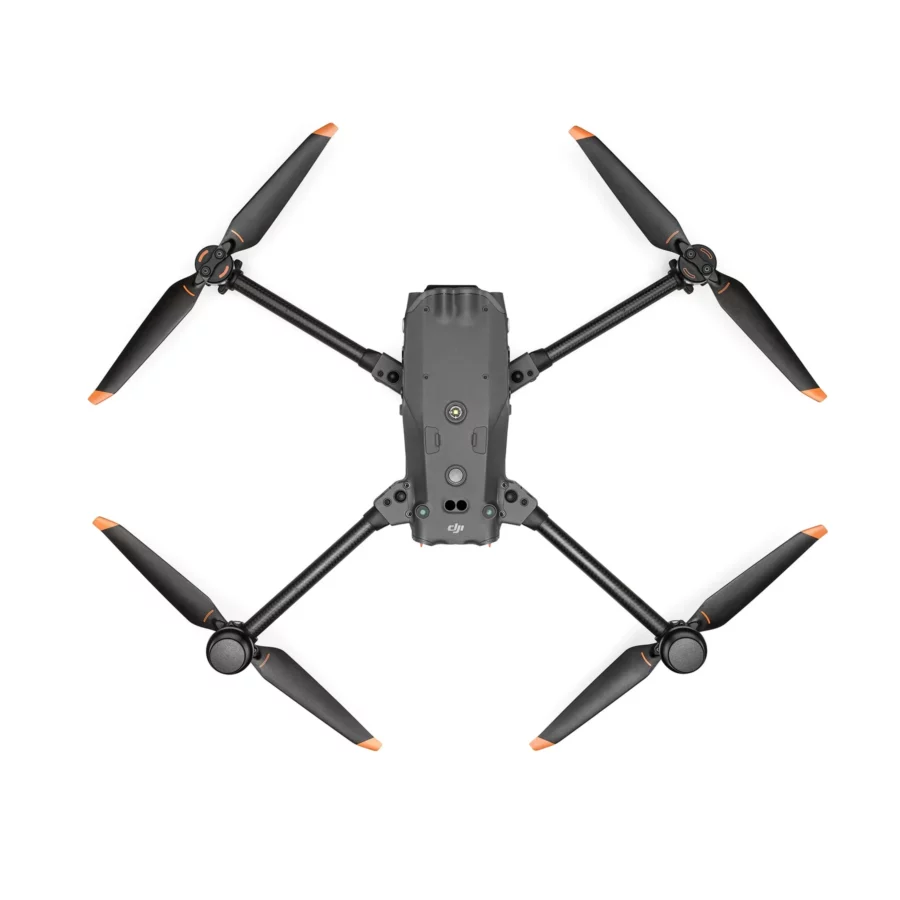
The DJI M30T Enterprise Drone by DJI represents a state-of-the-art aerial imaging solution for both professionals and enthusiasts seeking high performance and versatility. Equipped with advanced technology, the M30T’s high-resolution camera captures 4K video and detailed still images from impressive altitudes. Its stabilized gimbal ensures smooth footage even during rapid aircraft maneuvers. The thermal imaging feature enhances situational awareness, making it ideal for search and rescue, surveillance, and environmental monitoring. With intelligent flight modes, precise controls, and a sturdy design, the DJI M30T Enterprise Drone enables users to explore new perspectives and capture stunning aerial photography and videography. Whether for commercial or artistic purposes, the M30T transforms drone imaging and filming.
Versatile Integration Capabilities: The DJI Matrice M30T stands at the forefront of drone technology, designed for seamless integration with a variety of enterprise applications. This adaptable drone excels in numerous tasks, from aerial inspections to public safety operations and environmental monitoring, offering unmatched operational flexibility.
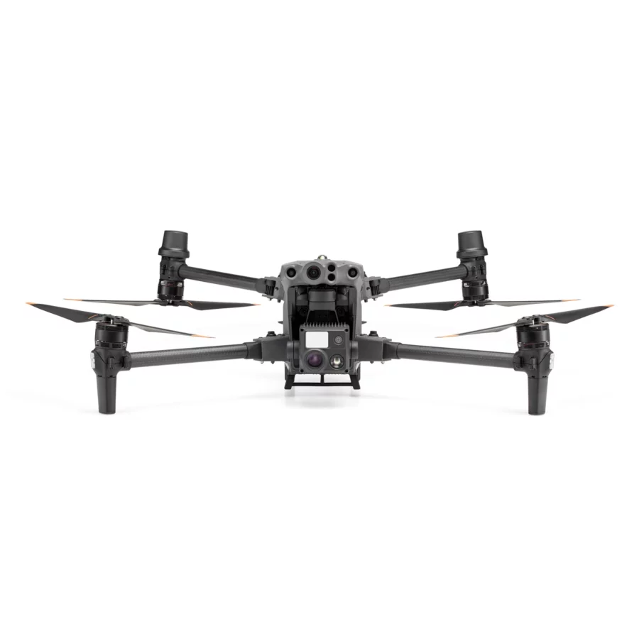
Comprehensive Advanced Imaging System: Featuring a cutting-edge quad-sensor setup, the M30T integrates high-resolution visual and thermal imaging, a powerful zoom function, and an accurate laser rangefinder. This comprehensive data capture approach allows operators to gather diverse data types in a single flight, boosting efficiency and depth of analysis.
Sophisticated Thermal Imaging: The built-in thermal camera is essential for tasks that require temperature measurements and heat source identification. This capability is vital for effective search and rescue missions, firefighting, and thorough inspections of infrastructure, providing critical information not visible to the naked eye.
Powerful High-Magnification Zoom: The M30T’s zoom camera boasts significant magnification, enabling detailed inspections of critical infrastructure from a safe distance. This zoom functionality allows operators to closely scrutinize structures without compromising safety, making it perfect for inspecting power lines, wind turbines, and other difficult-to-access assets.
Enhanced Low-Light and Night Operations: The drone excels in low-light conditions, ensuring operational readiness at any hour. This feature allows for continuous missions, even in challenging lighting, expanding its utility for nighttime surveillance and monitoring.
Durable and Robust Design: Built to endure demanding field operations, the M30T has a rugged, weather-resistant construction. This durability ensures reliability in various environmental conditions, including adverse weather, making it a dependable tool for professionals in challenging situations.
Extended Flight Endurance: Thanks to its intelligent battery management system, the M30T offers longer flight times, greatly enhancing mission duration. This extended endurance is crucial for thorough surveys, prolonged monitoring, and extensive search and rescue operations without frequent recharging.
Omni-Directional Obstacle Sensing: Equipped with advanced obstacle detection technology, the M30T can sense obstacles in all directions. This 360-degree sensing capability enhances safety during navigation through complex environments, protecting both the drone and its surroundings.
Reliable Advanced Dual-Transmission System: Utilizing both 4G cellular networks and DJI’s OcuSync 3.0 technology, the M30T ensures stable, long-distance communication. This dual-transmission system provides high-quality live video feeds and reliable drone control, even over vast operational areas, keeping operators informed and in command.
RTK-Enabled Precise Positioning: With Real-Time Kinematic positioning, the M30T achieves centimeter-level navigational accuracy, essential for tasks that require high spatial precision, such as detailed surveying, mapping, and critical infrastructure inspections, enhancing data quality and reliability.
Diverse Industry Applications: The M30T’s robust features make it an invaluable tool across numerous industries. Whether for utility inspections, public safety and emergency response, environmental conservation, or construction projects, the M30T delivers exceptional performance and adaptability.
Powerful Data Analysis Tools: Paired with advanced software solutions, the M30T efficiently transforms complex aerial data into actionable insights. These tools enable rapid processing and analysis of captured imagery and measurements, allowing operators to make informed decisions based on real-time data.
Modular Payload Flexibility: The drone’s modular design supports easy customization of payloads for specific operational needs. This flexibility allows for the integration of additional sensors and tools, ensuring the M30T can be tailored to meet the unique demands of each mission.
Intelligent Automated Flight Modes: The M30T features a range of intelligent flight modes that simplify complex operations. From automated waypoint navigation to dynamic subject tracking, these modes enable pilots to focus on mission objectives rather than manual controls, enhancing operational efficiency.
Enhanced GNSS Support for Reliable Navigation: With extensive support for global navigation satellite systems, the M30T maintains stable and accurate flight in various environments, including GPS-denied areas. This improved GNSS support ensures reliable operation, crucial for precision tasks and navigating challenging terrains.
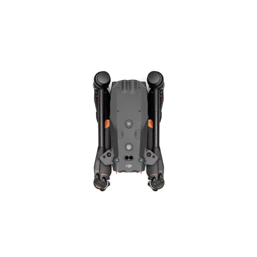
Rapid Deployment for Immediate Action: Designed for quick setup and deployment, the M30T includes user-friendly features such as quick-release propellers and a foldable structure. This readiness allows operators to respond swiftly to changing situations, ensuring the drone can be airborne within minutes to address urgent needs.
| Specification | Details |
|---|---|
| Dimensions | Unfolded (excluding propellers): 470 × 585 × 215 mm (L × W × H) Folded: 365 × 215 × 195 mm (L × W × H) Diagonal Wheelbase: 668 mm |
| Weight | Total (with two batteries): 3770 ± 10 g Max Takeoff Weight: 4069 g Max Takeoff Weight for C2 Certification in the EU: 3998 g |
| Operation Frequency | 2.4000-2.4835 GHz; 5.725-5.850 GHz |
| Transmitter Power (EIRP) | 2.4 GHz: <33 dBm (FCC); <20 dBm (CE/SRRC/MIC) 5.8 GHz: <33 dBm (FCC/SRRC); <14 dBm (CE) |
| Hovering Accuracy (in calm conditions) | Vertical: ±0.1 m (with Vision System); ±0.5 m (N-mode with GPS); ±0.1 m (RTK) Horizontal: ±0.3 m (with Vision System); ±1.5 m (N-mode with GPS); ±0.1 m (RTK) |
| RTK Positioning Accuracy (with fixed RTK enabled) | Horizontal: 1 cm + 1 ppm Vertical: 1.5 cm + 1 ppm |
| Max Angular Velocity | Pitch: 150°/sec Yaw: 100°/sec |
| Max Pitch Angle | 35° (N-mode and Forward Vision System enabled: 25°) |
| Max Ascent/Descent Speed | Ascent: 6 m/s Descent: 5 m/s Max Tilt Descent Speed: 7 m/s |
| Max Horizontal Speed | 23 m/s |
| Max Service Ceiling (above sea level, without additional payload) | 5000 m (with 1671 propellers) 7000 m (with 1676 propellers) |
| Max Wind Resistance | 12 m/s |
| Max Hover Time | 36 min |
| Max Flight Time | 41 min |
| Motor Model | 3511 |
| Propeller Model | 1671 (1676 for high altitude, not included) |
| Ingress Protection Rating | IP55 |
| GNSS Support | GPS + Galileo + BeiDou + GLONASS (GLONASS supported only with RTK module enabled) |
| Operating Temperature Range | -20° to 50° C (-4° to 122° F) |
| Class | C2 (EU) |
| Gimbal – Angular Vibration Range | ±0.01° |
| Gimbal – Controllable Range | Pan: ±90°, Tilt: -120° to +45° |
| Gimbal – Mechanical Range | Pan: ±105°, Tilt: -135° to +60°, Roll: ±45° |
| Zoom Camera – Sensor | 1/2″ CMOS, 48M effective pixels |
| Zoom Camera – Lens | Focal length: 21-75 mm (equivalent: 113-405 mm), Aperture: f/2.8-f/4.2 |
| Zoom Camera – ISO Range | 100-25600 |
| Wide Camera – Sensor | 1/2″ CMOS, 12M effective pixels |
| Wide Camera – Lens | DFOV: 84°, Focal length: 4.5 mm (equivalent: 24 mm), Aperture: f/2.8 |
| Thermal Camera – Imager | Uncooled VOx Microbolometer |
| Thermal Camera – Lens | DFOV: 61°, Focal length: 9.1 mm (equivalent: 40 mm), Aperture: f/1.0 |
| FPV Camera – Resolution | 1920 × 1080 |
| Laser Module – Wavelength | 905 nm |
| Vision Systems – Obstacle Sensing Range | Forward: 0.6-38 m, Upward/Downward/Backward/Sideward: 0.5-33 m |
| TB30 Battery – Capacity | 5880 mAh |
| Remote Controller – Screen | 7.02 inch LCD touchscreen, 1920 × 1200 pixels |




Reviews
There are no reviews yet.