

Description
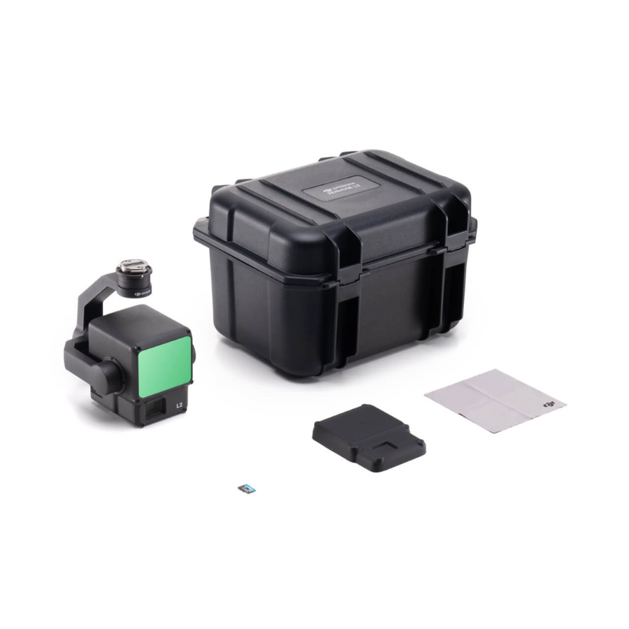
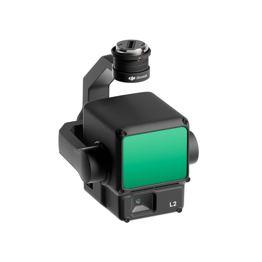
For hassle-free aerial mapping and surveying, the Zenmuse L2 LiDAR Camera Worry-Free Basic Combo is the ideal choice. This comprehensive package includes the Zenmuse L2 payload, tailored for efficient LiDAR and RGB data collection, along with essential accessories to enhance your drone surveying experience. The Zenmuse L2 LiDAR Camera ensures precise data gathering for environmental surveys, construction, and infrastructure monitoring, thanks to its advanced capabilities and high-resolution imaging. This combo provides a seamless aerial surveying experience, perfect for professionals seeking accuracy and efficiency in their mapping projects.
| Feature | Description |
|---|---|
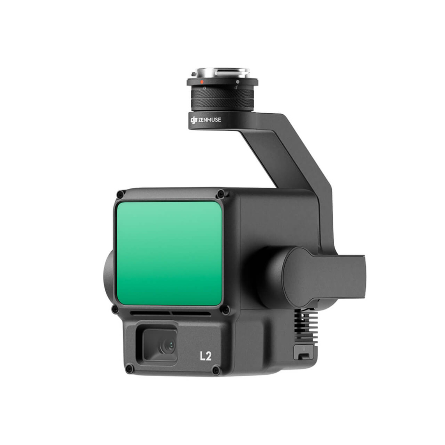
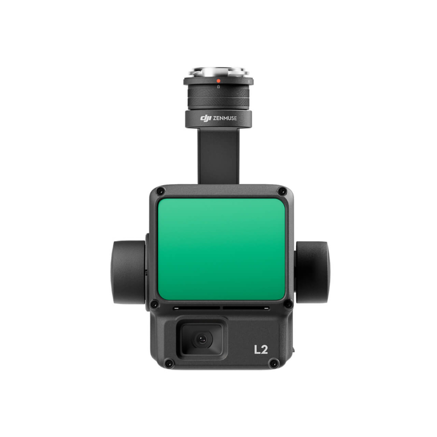
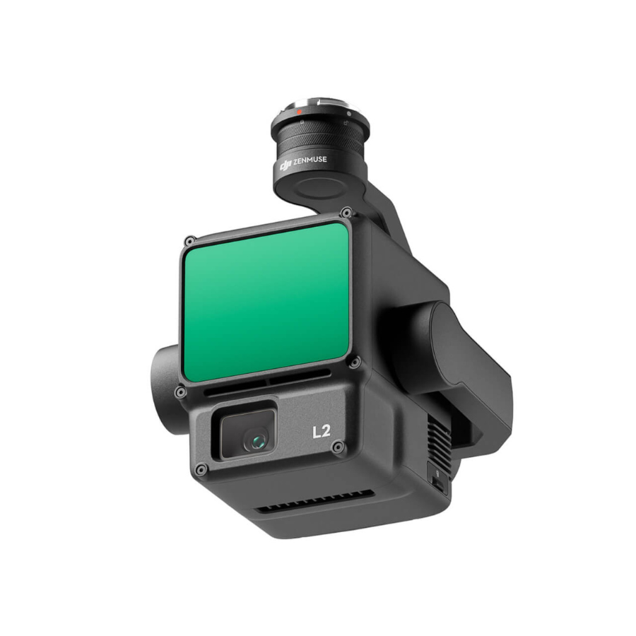
| Cutting-Edge LiDAR Module | The Zenmuse L2 features a state-of-the-art LiDAR module that utilizes the latest advancements in LiDAR technology. This module captures high-resolution, three-dimensional spatial data with exceptional accuracy, perfect for terrain mapping, infrastructure inspections, and surveying tasks over large areas. |
| High-Quality Integrated RGB Camera | In addition to its advanced LiDAR capabilities, the Zenmuse L2 comes with a top-notch RGB camera that captures vibrant, high-resolution images. This enables the creation of colorized point clouds, improving the visual documentation of surveyed environments. |
| Enhanced Detail with Smaller Spot Size | The Zenmuse L2 boasts a reduced spot size—one-sixth that of its predecessor at 100 meters—allowing detection of even the smallest objects. This precision is essential for creating detailed models and Digital Elevation Models (DEMs). |
| Optimized for Night-Time Operations | With LiDAR’s ability to operate independently of ambient light, the Zenmuse L2 is optimized for use in low-light conditions and at night, ensuring uninterrupted surveying and inspections. |
| Extended Operational Range for Versatile Surveying | The Zenmuse L2 achieves detection ranges up to 250 meters at 10% reflectivity and 450 meters at 50% reflectivity, supporting a wide range of surveying applications. |
| Designed for Optimal Performance at Ideal Altitudes | Operating best at around 120 meters, the Zenmuse L2 ensures comprehensive area coverage with high-resolution data capture. |
| Advanced Detection for Enhanced Environmental Analysis | The ability to detect and map smaller features significantly enhances environmental analysis and modeling, producing intricate, high-fidelity models. |
| Precise Digital Elevation Model Creation | The Zenmuse L2 specializes in creating accurate Digital Elevation Models (DEMs) essential for geological studies, construction planning, and flood risk assessment. |
| Comprehensive 360-Degree Scanning for Full Coverage | With its 360-degree scanning capabilities, the Zenmuse L2 ensures complete environmental coverage, capturing every detail of the surveyed area. |
| Efficient Data Processing Compatibility | The Zenmuse L2 integrates with DJI Terra and other leading data processing software, streamlining the workflow from data collection to analysis. |
| Robust Design for All-Weather Operation | Built to withstand various environmental conditions, the Zenmuse L2 guarantees reliable performance in adverse weather, ensuring consistent data collection year-round. |
| Intelligent AI Algorithms for Enhanced Data Interpretation | The Zenmuse L2 incorporates advanced AI algorithms for object recognition and tracking, simplifying complex data interpretation and enhancing decision-making. |
| Seamless Drone Integration for Enhanced Aerial Operations | Optimized for perfect compatibility with DJI’s Matrice series drones, the Zenmuse L2 is designed for easy attachment and high-performance aerial operations. |
| Secure Data Transmission for Protected Information Flow | The Zenmuse L2 includes built-in measures for secure data transmission, protecting sensitive mission data from potential security breaches. |

Reviews
There are no reviews yet.