Description
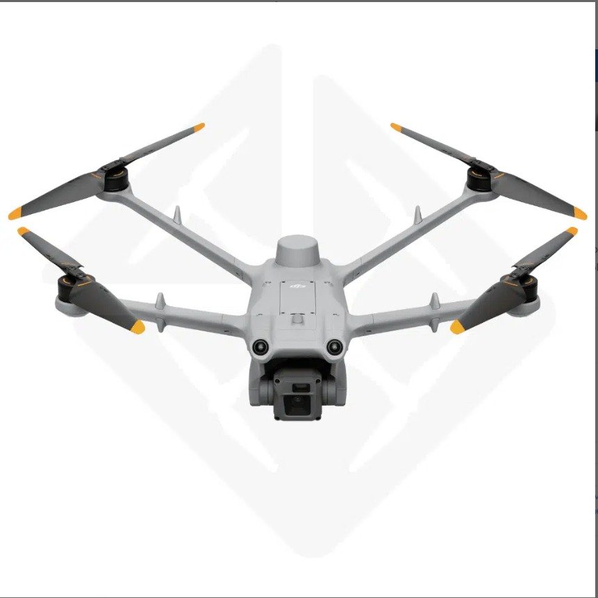
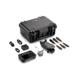
The DJI Matrice 3D is a high-performance DJI enterprise drone designed for versatile applications such as aerial mapping, surveying, and inspections. This advanced platform is equipped with cutting-edge technology and robust features that enhance its capabilities in various professional settings.
| Key Feature | Description |
|---|---|
| Powerful Flight Performance | Strong propulsion system for stable flight in challenging conditions, with a maximum flight time of up to 38 minutes. |
| High-Resolution Imaging | 4/3 CMOS sensor for capturing 20 MP still images and 5.1K video with smooth stabilization from the adjustable gimbal. |
| Smart Flight Modes | Includes intelligent flight modes like Waypoint, Follow Me, and Point of Interest for automating complex flight paths and precise data capture. |
| Enhanced Obstacle Avoidance | Multi-directional sensors for obstacle detection, providing an extra layer of safety during operations. |
| Robust Build Quality | Durable materials for industrial use, with a modular design for easy maintenance and upgrades. |
| Versatile Payload Options | Supports thermal cameras and multispectral sensors, suitable for agriculture, construction, and emergency response applications. |
| Intuitive Control System | Compatible with DJI’s advanced remote control and flight planning software for easy operation and real-time data management. |
| Extended Range | Transmission range of up to 10 km, providing flexibility to cover large areas without losing control or data quality. |
| Specification | Details |
|---|---|
| Weight | 1410 g (includes battery, propellers, microSD card, but excludes third-party payloads) |
| Max Takeoff Weight | 1610 g |
| Dimensions | 335×398×153 mm (L×W×H, without propellers) |
| Wheelbase | Diagonal Wheelbase: 463.2 mm Left-Right Wheelbase: 359.9 mm Front-Rear Wheelbase: 291.4 mm |
| Max Ascent Speed | 6 m/s (Normal Mode), 8 m/s (Sport Mode) |
| Max Descent Speed | 6 m/s (both Normal and Sport Modes) |
| Max Horizontal Speed | Normal Mode (Obstacle Sensing Enabled): 15 m/s forward, 12 m/s backward, 10 m/s sideways Sport Mode: 21 m/s forward, 18 m/s backward, 16 m/s sideways |
| Max Wind Speed Resistance | 12 m/s during operation, 8 m/s during takeoff/landing |
| Max Takeoff Altitude | 4000 m |
| Max Flight Time | 50 minutes (controlled environment, actual use may vary) |
| Max Hovering Time | 40 minutes (windless, 20 m above sea level) |
| Max Operating Radius | 10 km |
| Max Flight Distance | 43 km (actual use depends on conditions) |
| Max Pitch Angle | 25° (Normal Mode), 25° (Sport Mode) |
| Max Angular Velocity | 250°/s |
| Global Navigation Satellite System | GPS, Galileo, BeiDou, GLONASS (GLONASS enabled with RTK module) |
| Hovering Accuracy Range | Vertical: ±0.1 m (vision), ±0.5 m (GNSS), ±0.1 m (RTK) Horizontal: ±0.3 m (vision), ±0.5 m (GNSS), ±0.1 m (RTK) |
| Operating Temperature | -20° to 45° C (-4° to 113° F) |
| Ingress Protection Rating | IP54 |
| Motor Model | 2607 |
| Propeller Model | 1149 (foldable, non-quick release) |
| RTK Module and Beacon | Integrated on the aircraft |
| Image Sensor (Wide-Angle Camera) | Matrice 3D: 4/3 CMOS, 20 MP Matrice 3TD: 1/1.32-inch CMOS, 48 MP |
| Lens | Matrice 3D: 84° FOV, 24 mm format equivalent, f/2.8-f/11 aperture Matrice 3TD: 82° FOV, 24 mm format equivalent, f/1.7 aperture |
| Lens Defogging | Supported on both Matrice 3D and 3TD models |
| ISO Range | Matrice 3D: 100-6400 Matrice 3TD: 100-25600 |
| Shutter Speed | Matrice 3D: Electronic 8-1/8000 s, Mechanical 8-1/2000 s Matrice 3TD: Electronic 8-1/8000 s |
| Max Image Size | Matrice 3D: 5280×3956 Matrice 3TD: 8064×6048 |
| Still Photography Modes | Matrice 3D: Single (20 MP), Timed, Smart Low-Light, Panorama Matrice 3TD: Single (12 MP, 48 MP), Timed, Smart Low-Light, Panorama |
| Video Resolution and Bitrate | Matrice 3D: 4K at 130 Mbps, FHD at 70 Mbps Matrice 3TD: 4K at 85 Mbps, FHD at 30 Mbps |
| Photo Format | JPEG |
| Video Format | MP4 (H.264) |
| Image Sensor (Tele Camera) | 1/2-inch CMOS, 12 MP |
| Lens (Tele Camera) | 15° FOV, 162 mm format equivalent, f/4.4 aperture |
| Max Image Size (Tele Camera) | 4000×3000 |
| Digital Zoom | 8x (56x hybrid zoom) |
| Infrared Camera (Matrice 3TD) | Thermal Imager: Uncooled VOx Microbolometer, 12 μm pixel pitch Temperature Measurement Range: -20° to 150° C (High Gain Mode), 0° to 500° C (Low Gain Mode) Digital Zoom: 28x Infrared Wavelength: 8-14 μm |
| Gimbal | Stabilization: 3-axis mechanical gimbal Controllable Range (Tilt): -90° to +35° Max Control Speed (Tilt): 100°/s |
| Sensing and Obstacle Detection | Six-directional obstacle sensing, 10° blind spot in the upper rear area. Forward (0.5-21 m), Backward (0.5-23 m), Lateral (0.5-15 m), Upward (0.5-21 m), Downward (0.5-14 m). |
| Video Transmission | Transmission System: DJI O3 Enterprise Transmission Operating Frequency: 2.4 GHz, 5.1 GHz, 5.8 GHz (depending on local regulations) Max Transmission Distance: Up to 15 km (FCC), 8 km (CE/SRRC/MIC) Max Download Speed: Up to 15 MB/s (with DJI RC Pro Enterprise) |
| Battery | Capacity: 7811 mAh, 14.76 V, 115.2 Wh Max Charging Voltage: 17.0 V Cycle Count: 400 |
| Power Adapter | Input: 100-240 V (AC), 50/60 Hz, 2.5 A Output Power: Max output of 100 W |
Applications:
Aerial Surveying and Mapping: Ideal for creating high-resolution maps and models for construction, mining, and land management.
Infrastructure Inspections: Perfect for inspecting hard-to-reach structures like bridges, power lines, and wind turbines, reducing the need for scaffolding or cranes.
Agriculture Monitoring: Equipped with specialized sensors, it can assist in crop health analysis, irrigation management, and precision farming practices.
The DJI Matrice 3D stands as a robust tool for professionals looking to harness the power of drone technology in their operations, delivering unmatched performance and reliability across various industries.


Reviews
There are no reviews yet.