

Description
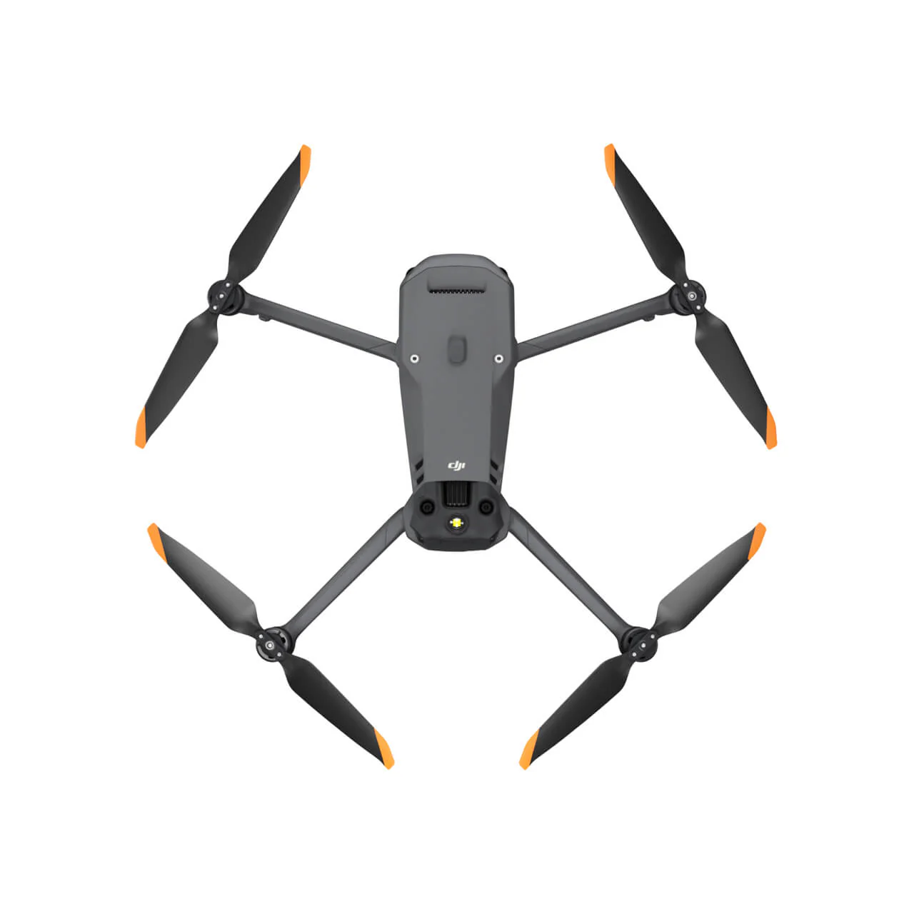
The DJI Mavic 3 Thermal Enterprise Drone (TE) represents a significant advancement in aerial imaging technology, specifically designed for professionals requiring superior thermal and visual capabilities. Here’s a breakdown of its key features and applications:
| Feature | Description |
|---|---|
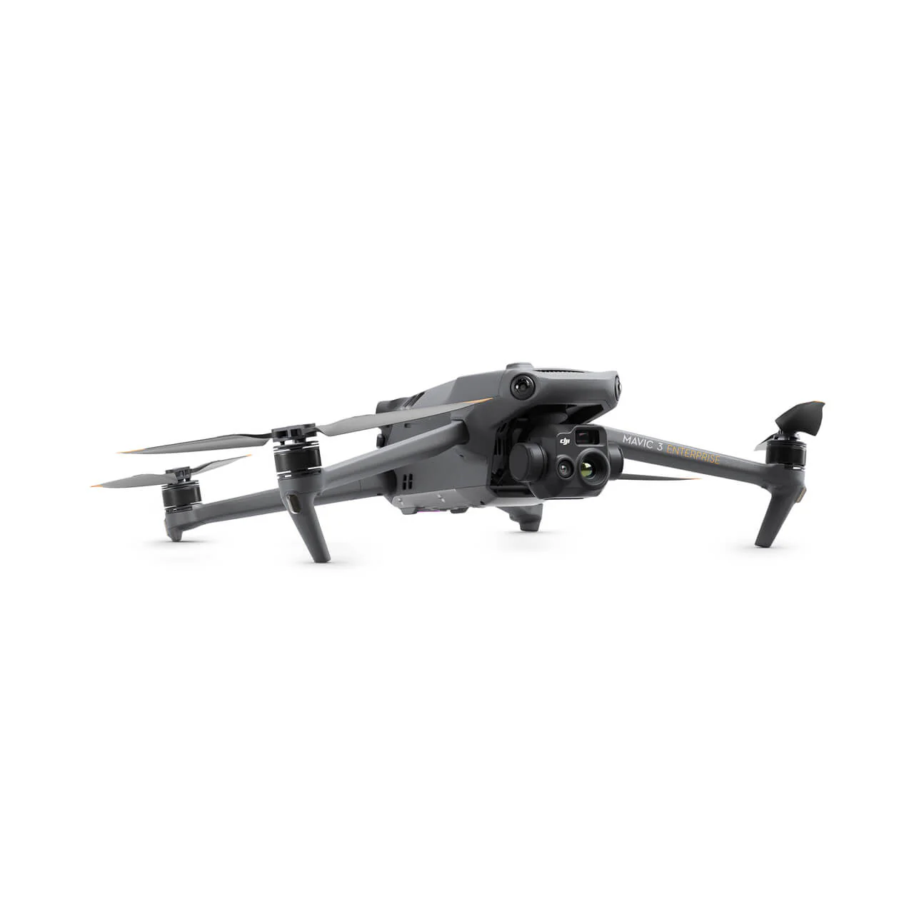
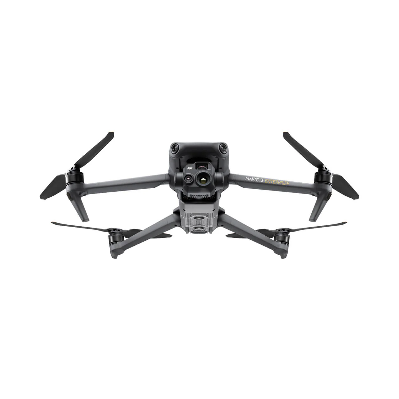
| Dual Camera System | Combines a high-resolution thermal camera and a 4K RGB camera, offering both thermal data and crisp visual footage for comprehensive aerial insights. |
| Advanced Thermal Imaging | Captures minute temperature differences, crucial for tasks like search and rescue, environmental monitoring, and infrastructure inspections. |
| Crisp 4K Visual Camera | Provides detailed 4K resolution, ideal for surveillance, inspections, and visual documentation. |
| Real-Time Image Switching | Operators can instantly toggle between thermal and RGB views, improving situational awareness during complex operations. |
| In-Depth Image Analysis Tools | Customizable isotherm settings and temperature measurements for thorough assessments and precise interventions. |
| Automated Flight and Data Collection | Ensures consistent and reliable coverage for agriculture, urban planning, and environmental conservation. |
| Extended Flight Time | Provides longer missions without frequent recharging, essential for large-scale projects. |
| Obstacle Avoidance System | Uses advanced sensors for safe navigation in challenging environments, reducing the risk of collisions. |
| Robust Connectivity | Maintains a stable transmission range, providing continuous real-time data for precision tasks and long-range missions. |
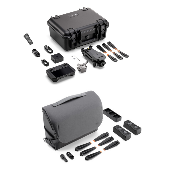
| Portable Design | Compact and foldable, enhancing portability and rapid deployment across diverse environments, from emergency response to routine surveys. |
| Accessory Compatibility | Compatible with various accessories, including spotlights and loudspeakers, for enhanced functionality in professional scenarios like night operations and crowd control. |
| All-Weather Operation | Built to withstand extreme heat or cold, ensuring reliable performance in various climate conditions. |
| GPS Tagging | Embedded GPS in every image and video for precise mapping and tracking of thermal anomalies and points of interest. |
Applications:
In search and rescue operations, the drone identifies heat signatures in challenging environments, aiding the quick location of missing persons.
For precision agriculture, it monitors crop health and manages resources efficiently by detecting temperature variations.
In infrastructure inspections, the drone helps pinpoint weaknesses in structures like power lines and pipelines through a combination of thermal and visual data.
In environmental monitoring, it detects temperature changes in sensitive areas, aiding in wildlife protection, fire monitoring, and other conservation efforts.
The DJI Mavic 3 TE excels in versatility, operational efficiency, and safety, making it an essential tool for professionals seeking advanced thermal and visual imaging in complex, demanding environments.


Reviews
There are no reviews yet.